Unique experiment: mapping of the permafrost to a depth of 500 m
November 12, 2020

Fig. 1. Fieldwork. In the photo: a receiver on a tap with antennas attached to a non-metallic cable, an all-terrain vehicle that provides movement along with a profile. An operator fixes the location of the equipment using a GPS receiver.
A unique study of permafrost strata to a depth of 500 meters was carried out in February-March 2020 in the Nadym region of the Yamal-Nenets Autonomous Okrug, Russia.
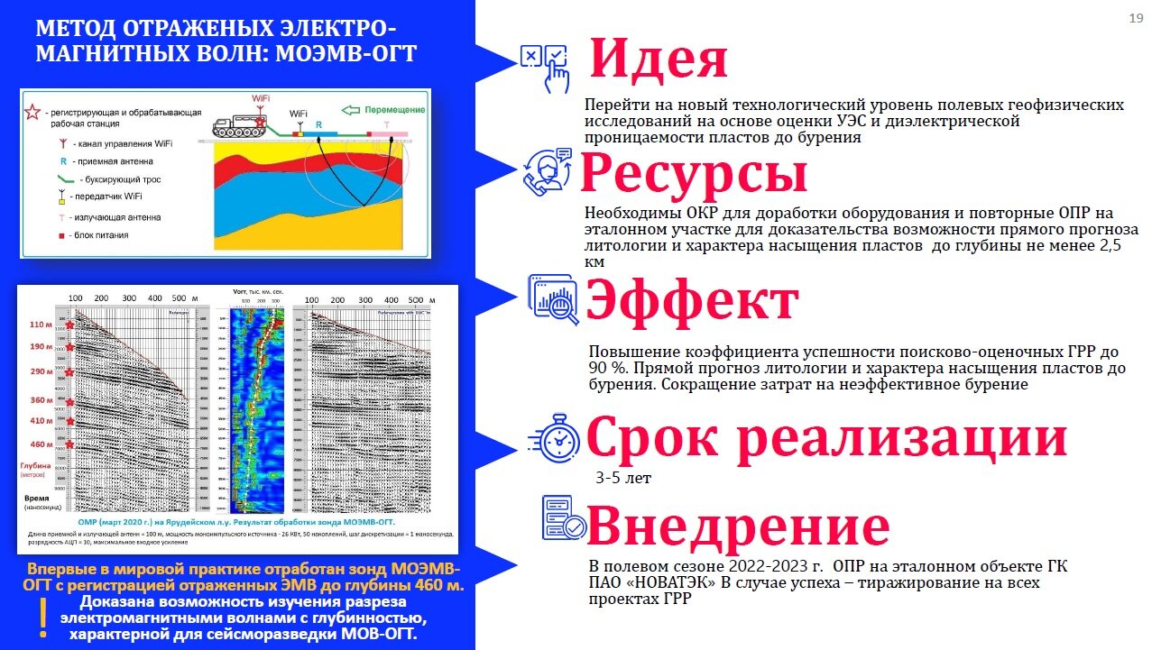
To participate in these works, our company has developed innovative electrical prospecting equipment for the method of reflected electromagnetic waves (MREMW) based on GPRs of the GROT 12 series. We used high-power transmitters and dipole antennas 30 and 50 meters long.
In the course of data processing, the deep GPR results were compared with the traditional methods of electrical prospecting and seismic exploration performed by other participants in the work.
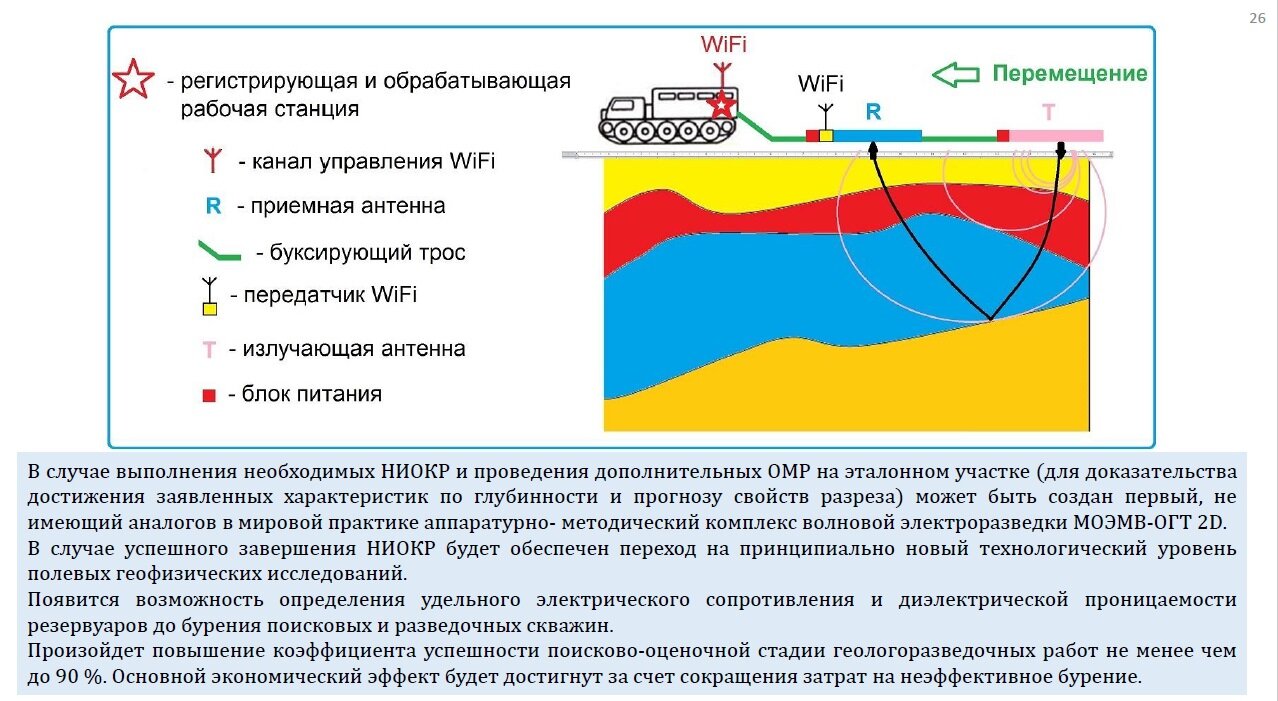
Description of the experiment on GPR profiling to a depth of 500 meters.

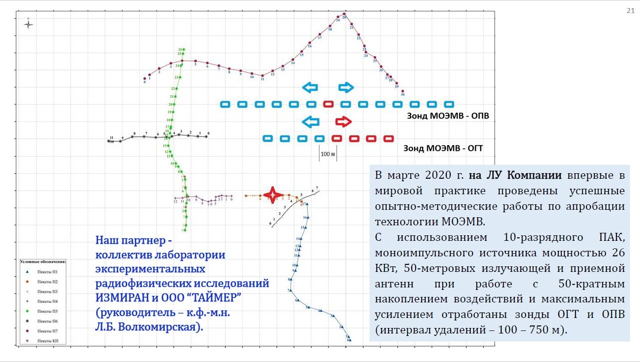
Fig. 2. The scheme of the experiment on profiling to a depth of 500 meters.
An all-terrain vehicle pulls a receiving unit (R) and a transmitting unit (T) on a non-metallic cable. The georadar is controlled by an operator from the vehicle via Wi-Fi.
To determine the optimal survey parameters and assess the penetration depth, experimental and methodological work was carried out, including the making of the hodographs (with a common source point and a common depth point), when the receiving and transmitting units are gradually carried away from each other.
Description of the experiment to register the hodograph (with a common source point) to a depth of 500 meters.
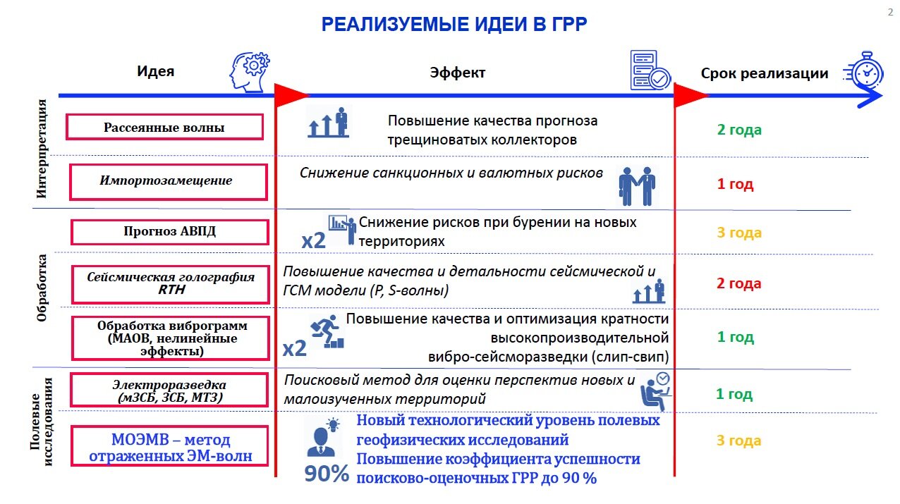
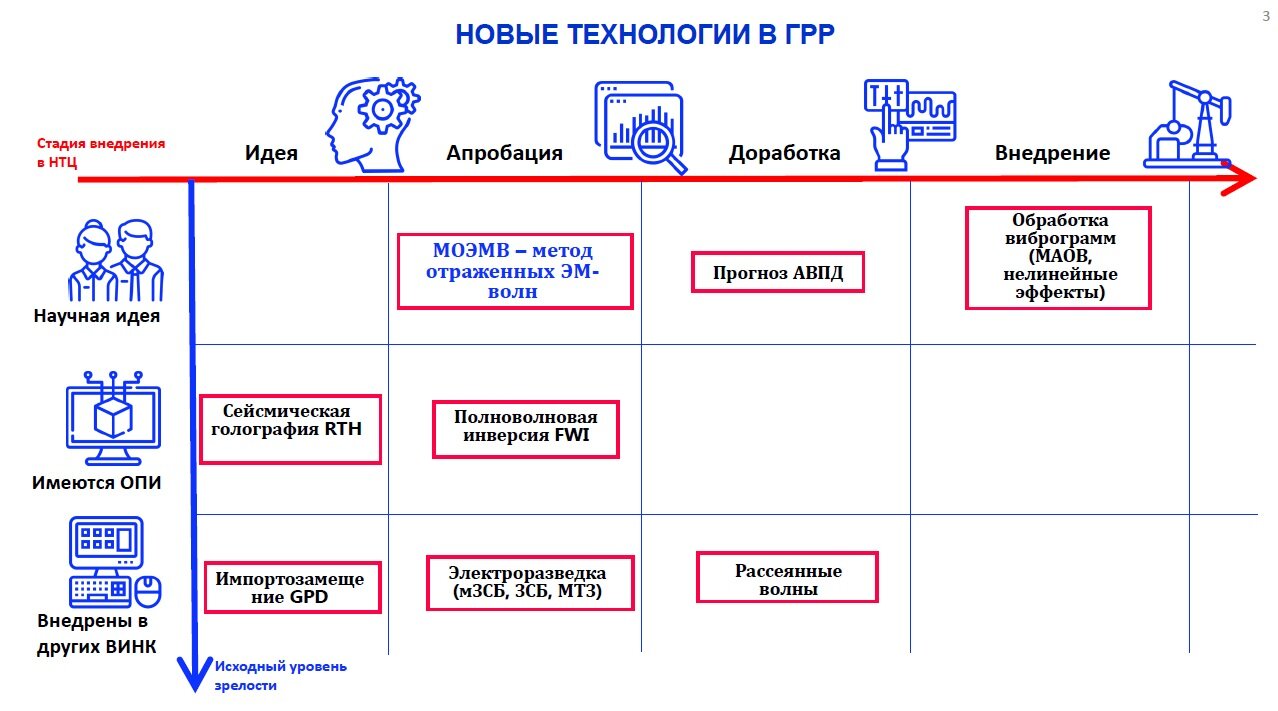
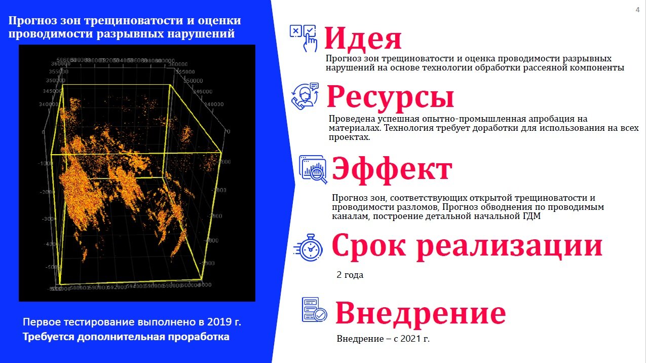
Based on the results of the data comparison of GPR with electrical prospecting and after independent processing of the raw GPR data, Novatek STC, LLC made a report “Key scientific and technological innovations in oil and gas exploration”, S.S. Sanin, Yu.N. Dolgikh, V.I. Kuznetsov (Novatek STC LLC) at the Tyumen Oil and Gas Forum (TNF 2020):
Quotes from the presentation:
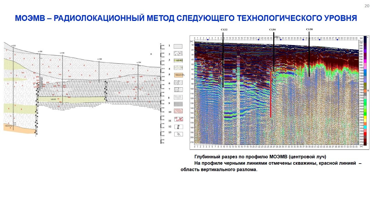
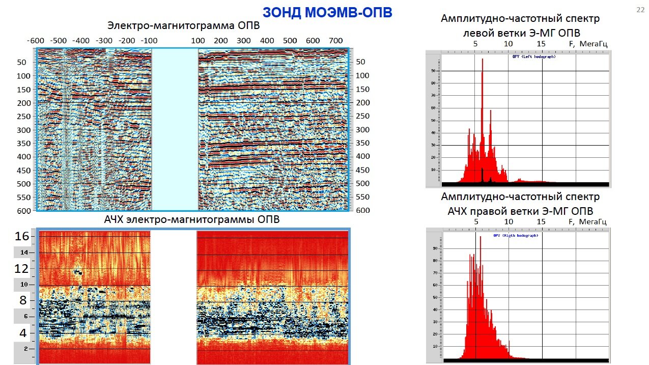
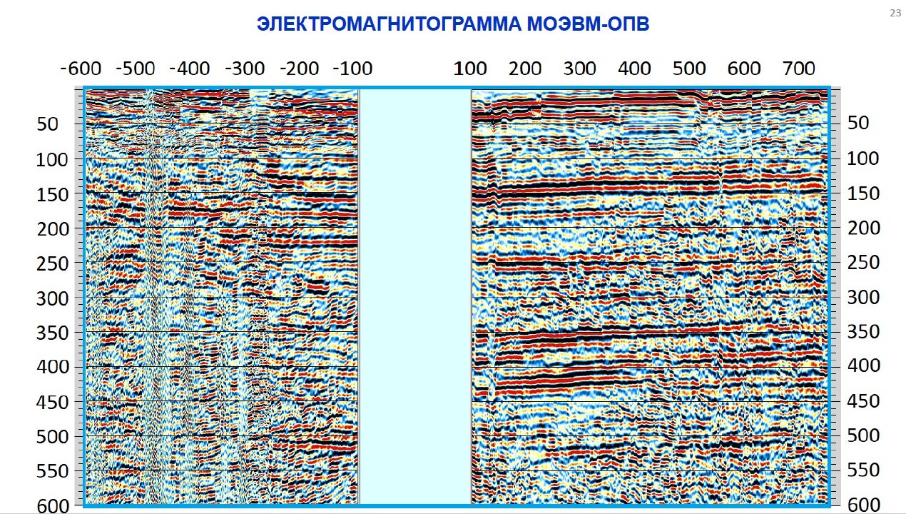
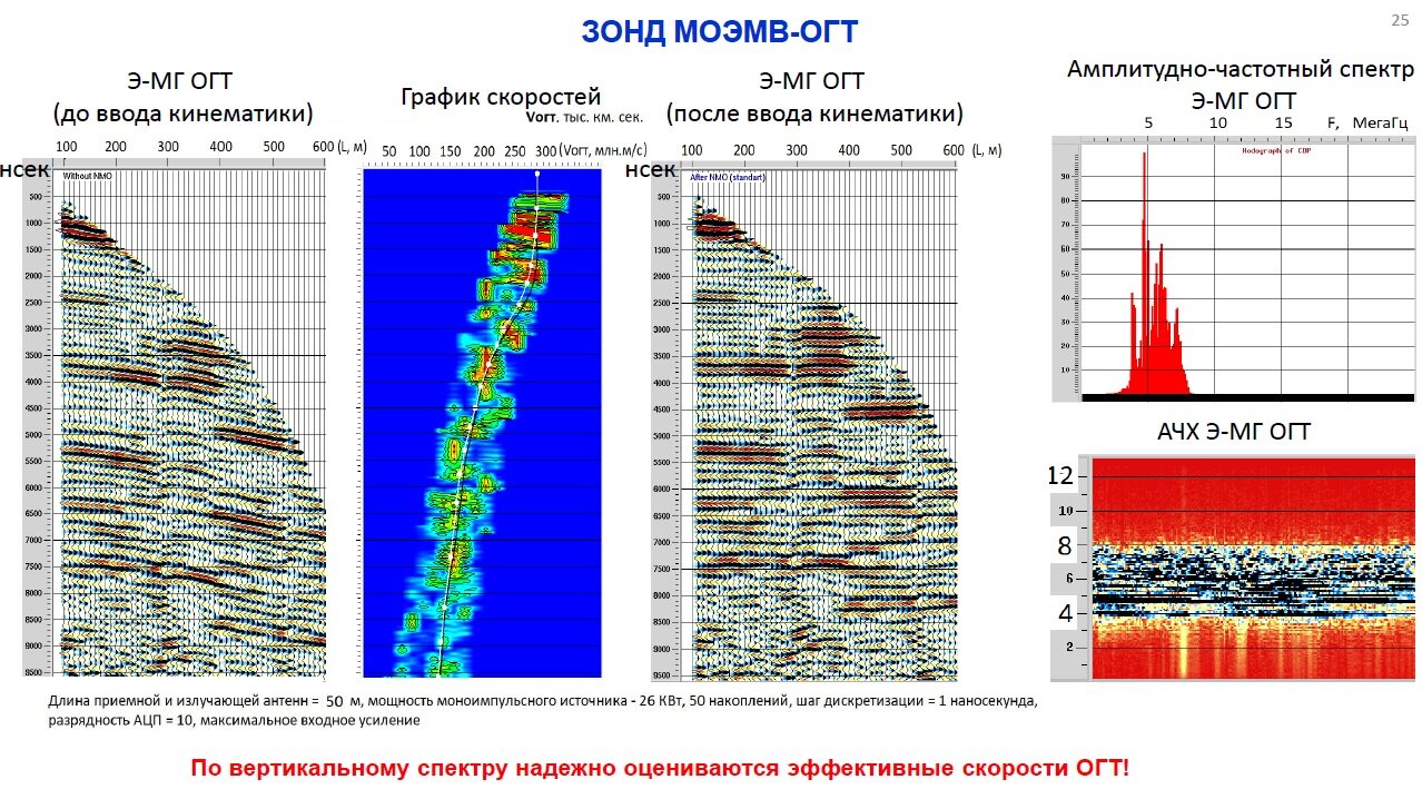
"For the first time in the world practice, the MREMW-CDP probe with the registration of reflected EMW up to a depth of 460 m was developed."
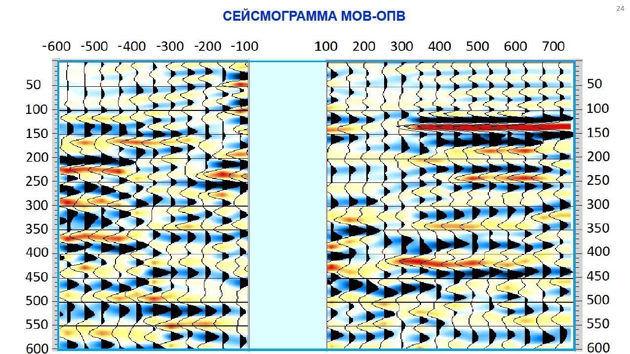
"The possibility of studying the section by electromagnetic waves with a depth characteristic of seismic exploration MOV-CDP has been proved."
"Effective CDP speeds are reliably estimated from the vertical spectrum!"