Monitoring of the salt dump state, Belarus
August 27, 2007

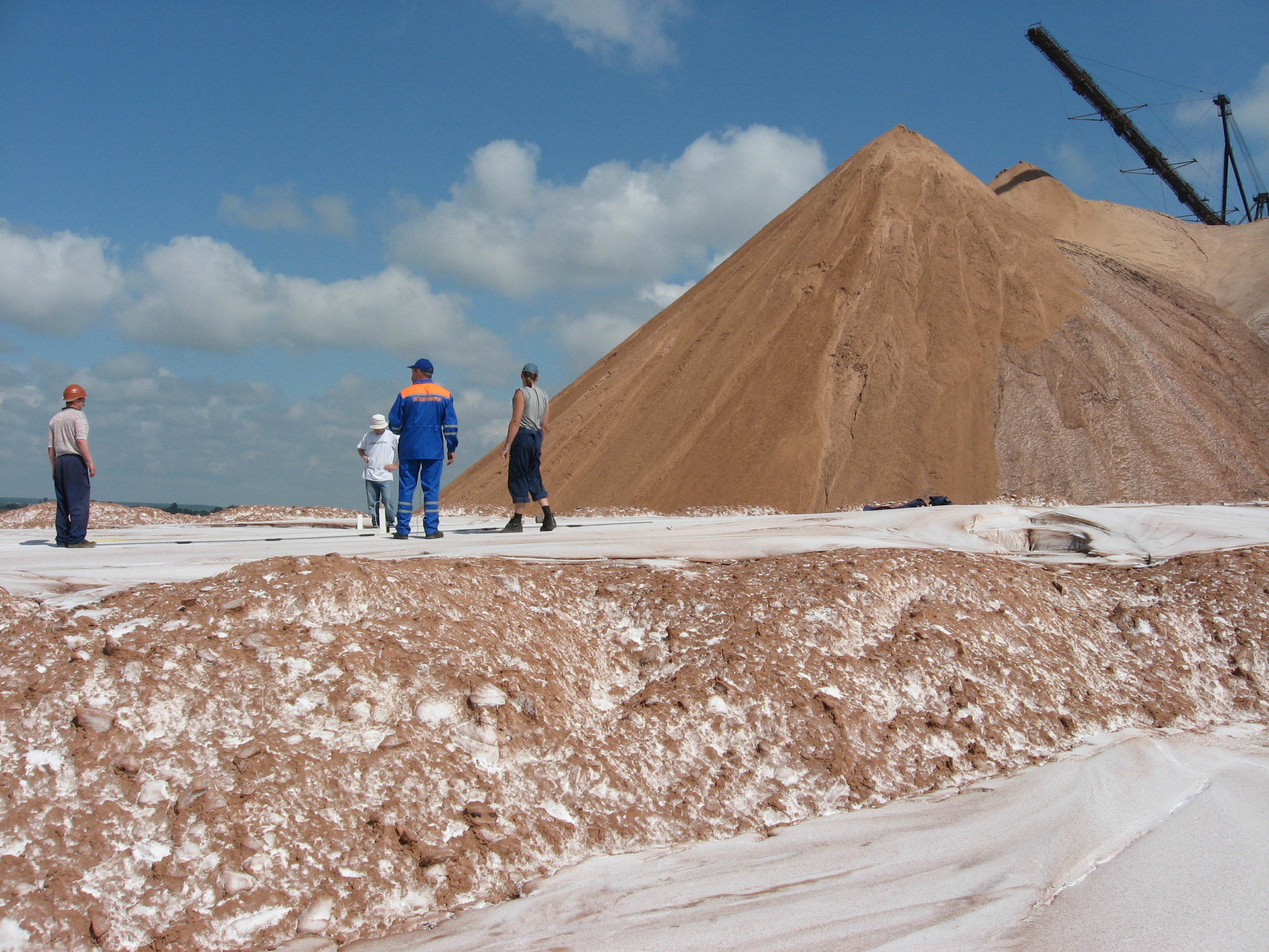
Works site
The works were carried out at the territory of joint potash production waste disposal by the specialists of "Belgorkhimprom" JSC with the usage of GROT 12 GPR, manufactured by Timer CJSC.
The salt dump GPR survey was made to analyse the state of the waste disposal area.
The territory under study had unusual structure: the salt dump was being made atop a sludge repository.
GROT 12 georadar is simple and convenient for usage, and the scanning results are visualized on the control computer monitor immediately during the scanning process.
Below is a layer-plate radargram, obtained during the scanning process on track number 10 with 4 meters long antennas:
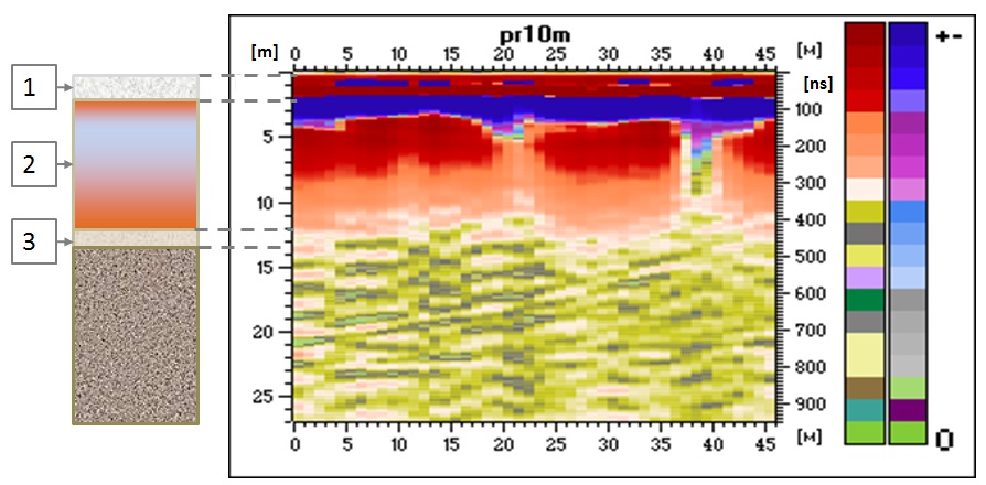
Fig. Radarogram of the section from the profile №10 obtained with antennas 4 meters long.
GPR scanning data was compared with the drilling data, and after that three main layers were distinguished:
1 layer (first 2.6 meters below the surface) - solid potash production waste - a very solid salt plate.
2 layer (from 2.6 meters to 12.3 meters below the surface) - liquid waste - wet heavily salted clay. The greater the depth the lower the humidity is.
3 layer (from 12.3 meters to 13 meters below the surface) - sludge storage base, which consists of backfill soil - fluvioglacial sands.
Below is the same radargram, but in "min-max" version:

Fig. Radargram in "min-max" version.
The saturated with brine zones between the 1st layer and 2nd (time delays of 100 ns) are visible on the radargram of the track, just as the zones of the second layer with varying values of moisture saturation (time delay up to 450 ns) and the salt solidification border (at the depth of 200 ns on the time delays scale).
Also clearly shows the upper limit of the bulk of the foundation soil slurry pits on the time delays of 500 ns.
The boundaries on larger time delays, for example 730 ns, are also seen on the track radargram.
This example demonstrates GROT 12 capabilities of scanning salted wet clay soils. The feasibility to scan media with high conductivity is a distinctive feature of GROT 12 type georadars.

We thank "Belgorkhimprom" JSC for the materials!