Study of coal mines liquidation effects
September 18, 2012
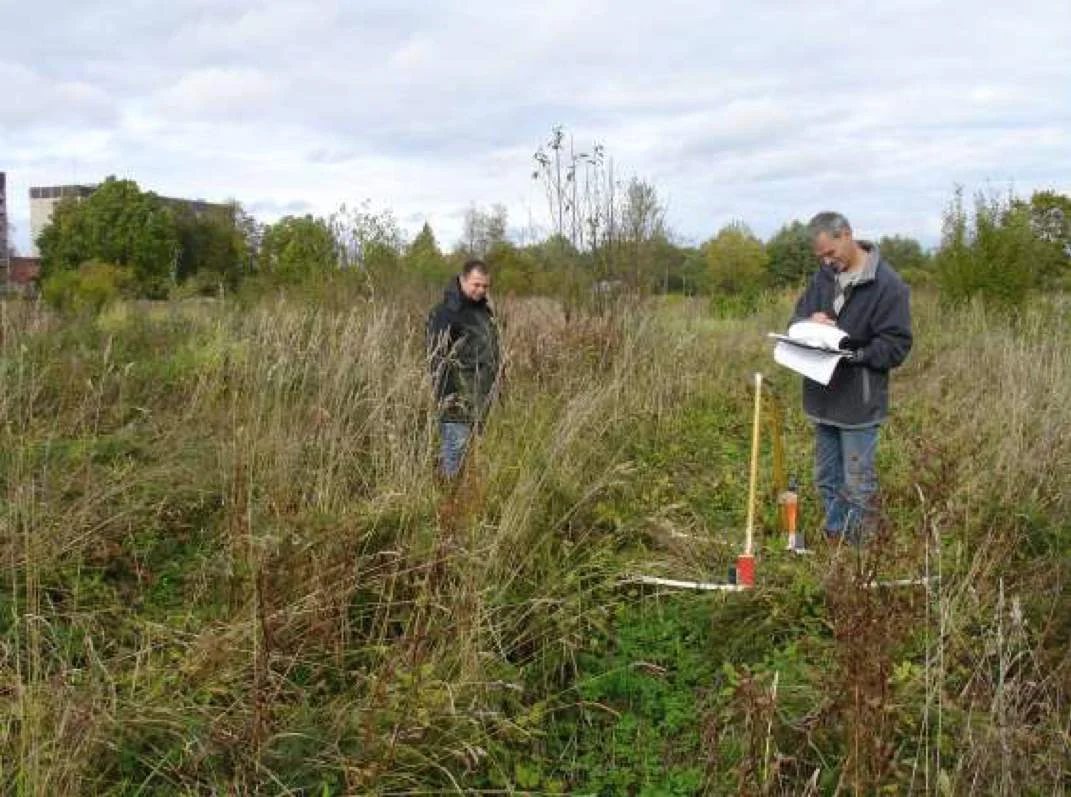
Fig.1. Site of works, Slantsevsky District of Leningrad Oblast, Russia.
On the basis of the agreement between the "Centre of Integrated Environmental Monitoring" and Timer CJSC the GPR survey of mining leases in S. M. Kirov and "Leningrad" abandoned mines was carried out to determine the feasibility of using the GPR scanning with GROT 12 type georadar to monitor the negative processes of mines liquidation.
The GROT 12 ground penetrating radar was used with the transmitters of different capacities (5, 9, and 15 kV) and the antennas with length of 2 and 10 meters.
The scientific and practical monitoring of industrial and environmental safety processes related to the liquidation of coal mines and quarries is essential. A disastrous accident at "Zapadnaya-Kapital'naya" mine in 2003 proved that it is important for the coal mining companies to promptly and accurately solve the security problems.
To meet the coal mines safety requirements during the liquidation, the mountain environmental monitoring should be carried out. The theory and methods of mining allotment surface monitoring during the coal mines liquidation haven't been fully developed yet, because the process of massive mines liquidation in Russian Federation has started relatively recently and scientific studies of such phenomena are still fragmented.
Liquidated mines shafts are artificially created voids in subsurface soils layers, which are the result of mineral resources production.
The underground karst at that site was characterized by the presence of strongly weathered zone of limestone. The formation of caverns along with the development of karst on the cracks is typical, as well as the destruction of rock to the state of rubble with the filler of sandy loam (limestone powder), gruss and rubble.
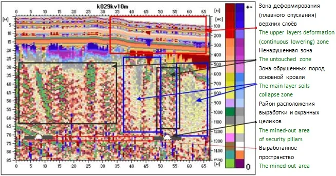
Fig. 2. The radargram with marked deformation zones.
Analysis of the radargrams of the K02 marked track in conjunction with a combined plan of the surface and mining works shows that the track crossed the mine workings, which were displayed at a depth of 68-72 m from the surface. From 0 to 30 m from the beginning of the track the karst formation processes at a depth of 30 meters could be seen, which didn't affect the upper layers of the soils.
A completely different picture is observed in the area from 30 m from the beginning of the track. The area of the collapse of the main layer rock is clearly discernible, just as the decompression and cracking processes. Also, deformation (continuous lowering) of rock layers at a depth of 15-20 m from the surface with the deformation of the surface took place.
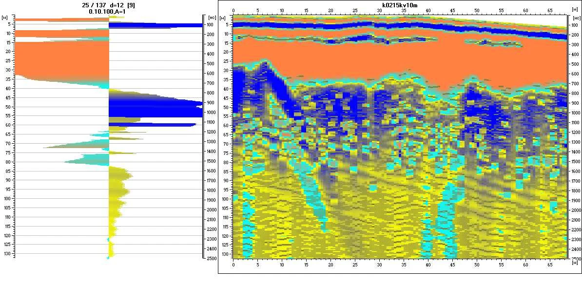
Fig. 3. Waveform (left) and a radargram (right).
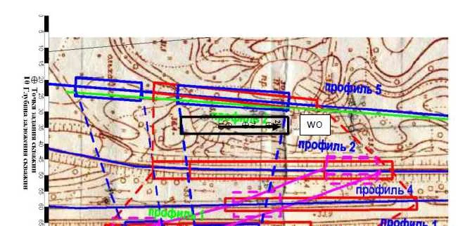
Fig. 4. Scheme of the tracks.
GPR method allowed us determining the parameters of the pillars and the deformation zones to a depth of 85 meters, which is greater than the mine developed space depth (68-70 meters). The application of GPR method for monitoring the situation and making prompt decisions on the prediction of adverse effects and their prevention was totally proved useful. The following are the GPR scanning data at mining allotment area of the Kirov mine.
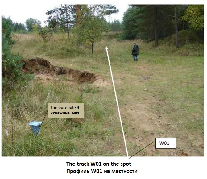
Fig. 5. GPR measurement track in the area of mining allotment of the Kirov mine.
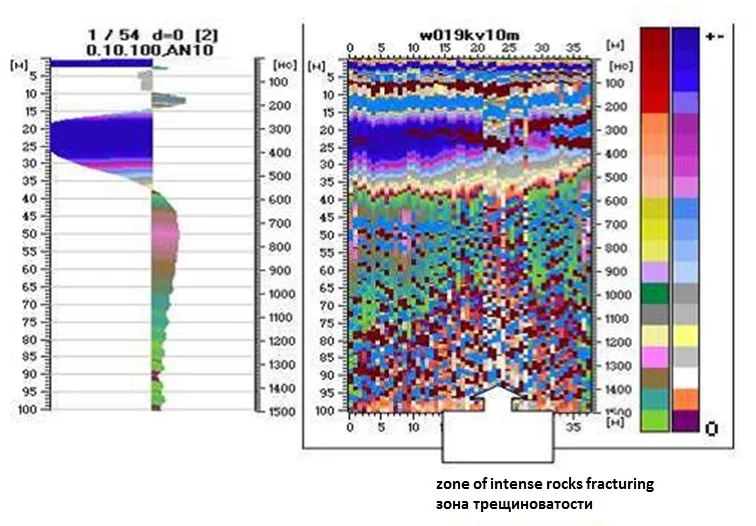
Fig. 6. Waveform and a radargram with marked zone of intense rocks fracturing.
A large area of water intensively saturated sands and carbonate rocks was allocated in the centre of the track over the zone of intense rocks fracturing. GPR survey data was compared with the data of drilling and electrical exploration.
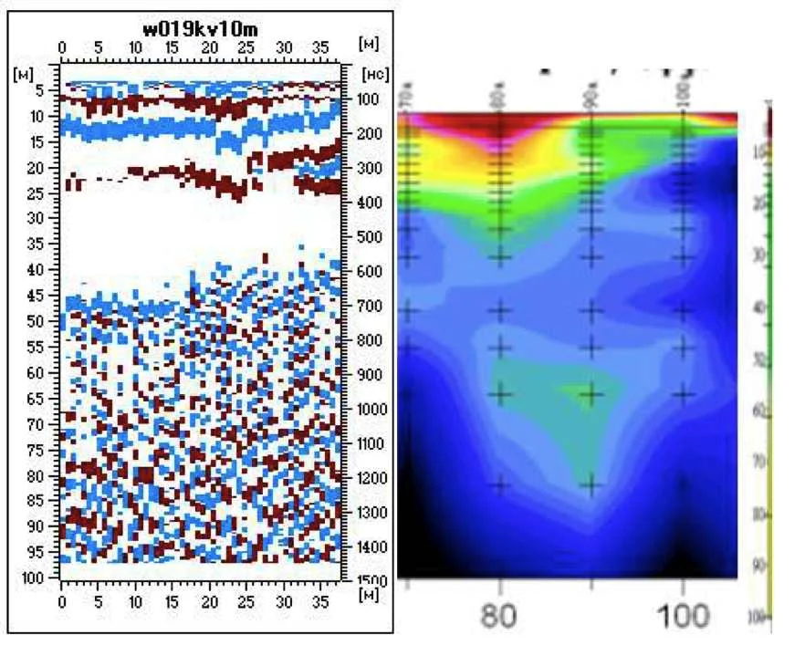
Fig. 7. GPR data (left) and electrical exploration data (right).
Comparison of the radargram in minimax representation, the track #5 area and electrical exploration and drilling data allows making a conclusion that the resolution of modern ground penetrating radars provides the detailed mapping of fracture and karst formation zones with an accuracy defined by the step value, while moving along the scanning track.